Can Nollywood Music and Films Teach us About Geography of Nigeria? (Not Related to Italy)

Music and Films are somethings that we use as entrainment now days vey often,some times those music and films talk about the feature that a place have. Today we are taling about Nigeria’s film industry, Nollywood, and how it can teach us about the geography of Nigeria.

Nigeria in Africa map

This map shows where Nigeria is in Africa.

“We are telling our own stories in our way, our Nigerian way, African way,” said director of Nollywood, Bond Emeruwa (Southern Innovator). Nollywood is located in Nigeria, which is in the North of Gulf of Guinea, West Africa. Nollywood is also one of the biggest film industries in the whole world, rank third place after USA’s Hollywood and India’s Bollywood  (Afropop Worldwide). Nollywood is famous for the speed of producing a film (Afropop Worldwide). An average production takes just 10 days and costs approximately $15,000 (Thisisnollywood.com). The films’ themes in Africa revolve around AIDS, corruption, women’s rights, the occult, crooked cops and prostitution (Southern Innovator). The music in Nollywood films is mostly play by flute, drums, trumpet and stringed instrument (Afropop Worldwide). Nollywood can teach us about the geography of Nigeria, include culture, history, and the relationship between tradition and modern through its films and music.

Nollywood films and music can teach us about Nigeria’s grography about its culture, such as sacrificing people, culture diversity, and the culture change after Nollywood arise.  One of the famous films that Nollywood produce, called Living in Bondage (Afropop Worldwide),

Living in Bondage cover photo

This is the cover photo for Living in Bondage

it’s a movie about the Nigeria in 1970s that are spoke in Igbo language, and females play more like a servant or low class in this time (Oghale). The wife in this film were working hard for their kids but got sacrificed by her husband for quick wealth (Oghale). This film teaches as about the social stander that women were having in 1970s. Also, it teaches us that there is a culture says to sacrifice other people (Afropop Worldwide). The other epic film produced by Nollywood called Laviva. It set during the Liberian civil war and it’s speaking in English (Modern Ghana). This represent English is one part of their culture, also, as what I mention before Living in Bondage is spoke in Igbo language, which means we learn there are at least 2 type of language in Nigeria’s geography. After Nollywood arise, there is one more thing in their culture called film culture, and other parts culture had been affected by it, such as music. After Nollywood arise, a music called Take U To Da Movies, created by a Sudanese-Australian hip-hop artist. The rise of Nollywood affects people from Nigeria and other country, because of its cheap price (Afropop Worldwide). Many people are able to afford it, which made some more people are setting up little movie theater for broad audience, and this create film culture (Afropop Worldwide). The films and music let us know the geography of Nigeria about its culture, such as sacrificing people, multiple languages, and film culture.

Nollywood film and music can’t only teach us the geography of Nigeria about Nigerian culture, but also history. Laviva, the film that I mention before, it explains parts of history about Nigeria. It’s set during the period of Liberian civil war, so it teach us that Nigeria are involved in this (Modern Ghana).

This is the cover photo for Half of a Yellow Sun.

This is the cover photo for Half of a Yellow Sun.

Half of a yellow sun, a movie produced in 2007 and based on a famous novel in Nigeria (The Sun News). This film can teach as about the history of Nigeria, because it is set during the period of civil ……war (The Sun News). This film also shows the mass amount of death by the  military troops and people losing their homes (The Sun News). Nollywood film or music can teach us the geography of Nigeria about it’s history, such as the civil wars.

Culture and history are not only things that the Nollywood product can let us learn about the geography of Nigeria, also the relationship between traditional and modern. In the daily life that Nigerians have is to argue about the movie, sometimes argue about is the movie even any good, some movies are mix with the theme of evil (Afropop Workdwide). “In some cases, they demonize traditional religion by panting sedan traditional practices as not only evil, also uncivilized… They demonize traditional religion, they demonize traditional system, they demonize everything traditional, because they are not modern.” (Afropop Workdwide). Only culture and history, we also learn that traditions are sometimes demonized from Nollywood films.

Nollywood can teach us about the geography of Nigeria, include culture, history, and the relationship between tradition and modern through its films and music. The films and music can teach as about it’s culture, such as people sometimes sacrifice other people for wealth in 1970s, there are multiple languages spoke in Nigeria, and the effects Nollywood films had on music. Second, it can teach us about the civil wars the Nigeria had before. Third the Nollywood films and music teach us that traditional systems, religion, etc. are demonized because they are not modern. Nollywood film and music are like a mirror to Nigeria. It reflex and let us know the geography of Nigeria through the topic or the content of the film or music.

This is the map of Nigeria that shows all the cities in there.

This is the map of Nigeria that shows all the cities in there.

Work Cited:


“Nollywood: Booming Nigerian Film Industry.” Southern Innovator. Web. 7 June 2015. <http://www.southerninnovator.org/index.php/home/1-creative-econ/9-nollywood-booming-nigerian-film-industry&gt;.

“Nollywood: Nigeria’s Mirror.” Hip Deep: Afropop Worldwide. Web. 7 June 2015. <http://www.afropop.org/4875/nollywood-nigerias-mirror/&gt;.

“About Nollywood.” Thisisnollywood.com. Web. 8 June 2015. <http://www.thisisnollywood.com/nollywood.htm&gt; .

Oghale, Emily. “The self- sacrificing image as a genre in Nigerian video.” Web. 16 June 2015. <http://www.ajol.info/index.php/cajtms/article/viewFile/91766/81236&gt;.

“Nollywood rebrands Nigeria with Laviva.” Modern Ghana. 14 Apr. 2007. Web. 16 June 2015. <http://www.modernghana.com/movie/898/3/nollywood-rebrands-nigeria-with-laviva.html&gt;.

“The Problem with Half Of A Yellow Sun.” The Sun News. 15 Aug. 2014. Web. 18 June 2015. <http://sunnewsonline.com/new/?p=76962&gt;.

Global Problems – Solutions to the Italy Illegal Immigration problem

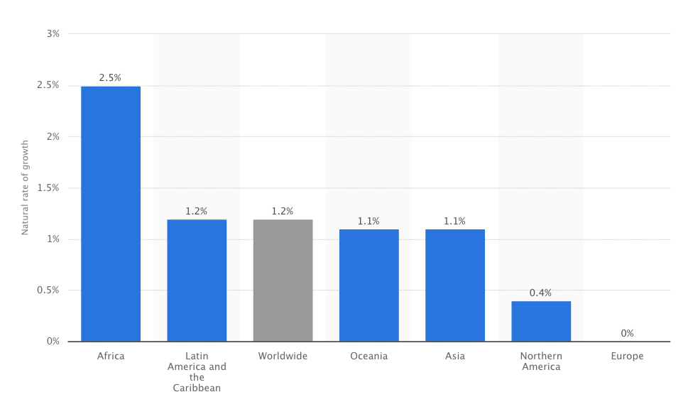
Some problems are effective to the whole world, which are sometimes very harmful to the society, economy, or security. For example, air pollution, aging population, deforestation, human rights, racism, and illegal immigration.

Today we are here to talk about one of the problems and some ways to solve it: Illegal immigration.

The Deadly Journey of Illegal Migrants from Africa to Italy and the Serious of Illegal Migration Problem

Introduction 1:

On 30 June 2014, a boat with 566 people and 30 corpses was found by the Italian Navy (Associated Press). Those people are citizens from Libya that paid thousands of dollars to the smugglers who will send them to Europe (Associated Press). Those people choose to take the risk of illegal migration because of push and pull factors (BBC). The movement of people move from one place to another is called Migration (BBC). People migrate for different reasons, it can be economical, social, political or environmental” (BBC). There are two types of migration: internal migration and international migration. Internal migration is when people migrate in the same country (BBC). International migration involved different country, it’s when people migrate from one country to another (BBC). The people who choose to migrate are mostly people who are young, between 15-24 years old, high income, underemployed, or educated, mostly between high school to college (Ray and Esipova). Push factors may include crop failure, drought, flooding, poverty, war, and lack of services (BBC 2). There are also multiple pull factors, such as higher employment, more wealth, better services, good climate, safer, less crime, political stability, more fertile land, lower risk from natural hazards (BBC 2). Illegal migration is when people migrate from one place to another without the permission of the country or border (Eschooltoday). In order to understand how illegal migration is a serious problem to the world and Italy, we can look at how illegal migrants affect countries at the global scale and national scale.

Introduction 2, global scale:

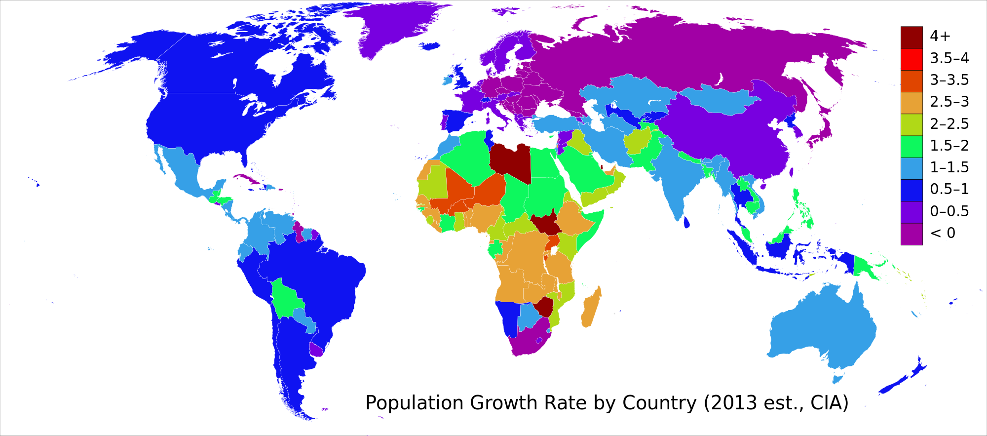
We can first look globally, the illegal immigrants affects many countries no matter poor or rich, such as USA, Mexico, Malaysia, Myanmar, Indonesia, Cambodia, and Australia. The illegal immigrant from Mexico to USA makes up about 2% of population in United State in 2012, which are about 5.9 million people (Krogstad & Passel). Those illegal migrants from Mexico come to the USA, because there are crime, drugs, corruption, and a troubled economy in Mexico, and higher opportunity to get hire in the United State (Pew Research Centers). In many states, such as Nevada, California, Texas, and New Jersey, over 5% of the labor force are illegal immigrants  (Krogstad & Passel). This  hurt the economy because those jobs were taken by the illegal immigrants which are originally going to be legal citizens’ (Davidson). There are many illegal immigrants coming from other countries like Myanmar to Malaysia, where there are about 3 million illegal immigrants from Myanmar (Wafazli Store). People from Myanmar come to Malaysia because they are seeking a safer and politically stable place, which Malaysia fits the description for them so they do whatever it take to cross the sea even if they break the law and become illegal immigrants (Wafazli Store). The illegal migrants threaten Malaysia’s security because some of them might be the most unwanted terrorist in their country and (UKEssay). Also, Australia, Indonesia, and Cambodia have been affected. Many illegal immigrants in Australia come from Indonesia (One Nation). Those illegal immigrants come to Australia to seek for jobs, even though they know they are going to become illegal migrants (International Labour Organization) .To solve this problem, they signed an agreement to move some of them to Cambodia (Sambath). The illegal immigrants affect many countries in different way, such as economy, politically, and socially, which makes it a global problem to all parts of the world.

Introduction 3, Italy scale:

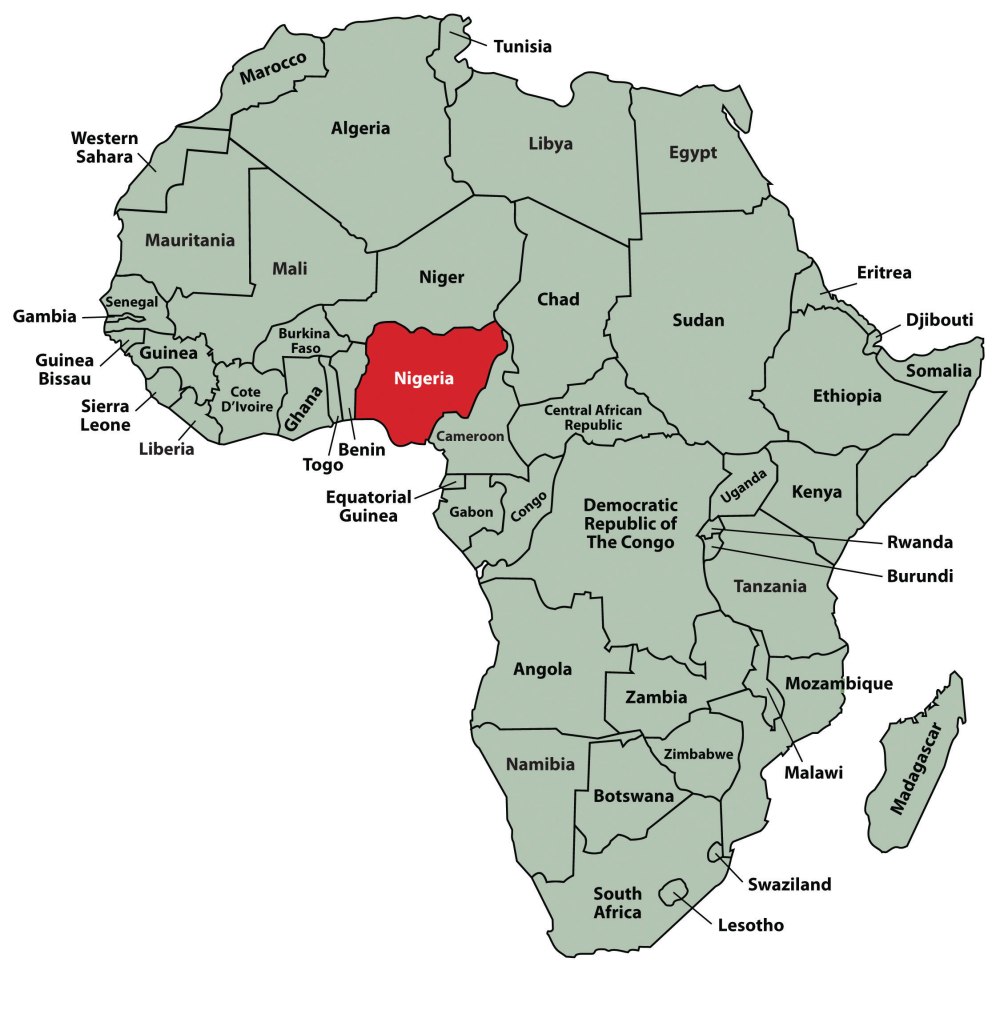
After looking at global scale, we can go more specific to the national scale, which is looking at how does illegal immigration affect Italy. Italy received 170,000 illegal immigrants from Africa, especially from Syria and Eritrea in 2014 (BBC), and there are at least 23,000 migrants who died trying to reach Europe since 2000 (The Economist). The boat with illegal immigrants on it might mix with terrorist on it, and it had really happen on May 17, 2015 (BBC). The Italian ambassador said, “ There are a potential security threat to the whole of Europe in terms of terrorist and criminal infiltration, besides the economic concerns.” (EurActiv).The illegal immigrants’ boats affect the the number of death in the world, also the political threat to Italy and Europe. Illegal immigration is a problem that’s threatening Italy, also affecting the whole world at the same time. Since it’s a very serious and huge problem to the whole world, we need the governments or private companies work together in order to solve this by using guest worker program, stop the war between other countries, legalize the illegal immigrants, and use online verification of immigration status by employers.

Body Paragraph 1 Government solution:

The ways governments can solve the problem of illegal immigrants is by using guest worker program, legalize the illegal immigrants and stop the war between other countries. Guest worker program is program that allow foreign worker to enter the country for a specified period of time and fill a specific job (Moffett). One of the examples is Bracero. It has been proven successful by the history (Nowrasteh). In 1953, 2 million illegal immigrants from Mexico entered United State, but after Bracero activated, within two years, the amount of people shrunk by 90 percent (Nowrasteh). By legalizing the illegal immigrants, it created benefits like “makes the country more productive, makes the economy more flexible, and offers a mix of cultural benefits” (ListLand). The people who become legal immigrants contribute in the countries economy through increased workforce, more taxes to the government, and more investments (ListLand). Guest worker program are a bit different from legalizing illegal immigrants, because guest worker program is focusing on the people who’s coming to the country, and legalizing illegal immigrants is focus on people who’s already in the country. Like what I had said in the first paragraph, war is one of the push factors that cause people to migrate (BBC). So, if we stop the wars, we can decrease the amount of people from migrating illegally, like the people on the boat that was found by the Italian Navy on June, 30 2014 (Associated Press). There is massive amount of wars happening all around the world, including in Africa. In Africa, war is caused by lots of ethnic and religious diversity, but mostly by “high levels of poverty, failed political institutions and economic dependence on natural resources” (Elbadawi and Sambanis). We need to stop wars in order to solve illegal migration problem, and it needs other forces out from Africa, such as UN or governments (Stremlau). The things that the governments can do to stop the wars include “ help governments establish fair distribution policies” and “strengthen democratic institutions and support good governance” (Stremlau). In order to solve the problem of illegal immigration by the governments they can start using guest worker programs, legalize the illegal immigrants and stop the war between other countries.

Body paragraph 2, Private Company Solution:

Not only can governments help to solve the problem of illegal migration, but also the private companies. They can help the solve this problem by using online verification of immigration status by employers. One of the examples is E-verify (Matthews). Business owners can use this kind of online service to know their migrant workers’ legal status and prevent themselves from hiring them if they are illegal immigrants. One of the pull factors that cause people to migrate is higher employment rate, so if the business owners don’t hire illegal immigrants, there will not have this pull factor and the problem will become less serious (BBC). The illegal immigration problem will be solved by the help from the governments and private business owners if they use guest worker program, stop the war between other countries, legalize the illegal immigrants, and use online verification of immigration status by employers.

Conclusion:

Illegal immigration is a serious problem to the world, because many people died from trying to illegal migrate to the other country. In order to solve this problem, we needs governments and private companies work together by using guest worker program, legalize the illegal migrants, stop the war between other countries, and use online verification of immigration status by employers. Guest worker program can give people right to work in the other country legally and has historical example to prove it’s useful. By legalizing the illegal immigrants, it “makes the country more productive, makes the economy more flexible, and offers a mix of cultural benefits” (ListLand). By having help from other countries, such as help the local governments establish fair distribution policies” and “strengthen democratic institutions and support good governance”(Stremlau), they can stop war and solve this problem in the same time. Online verification of immigration status by employers helps the business owners to know their migrant workers’ legal status and prevent themselves from hiring them if they are illegal immigrants. Huge amount of people die from trying to migrate to the other countries globally, if we just look at Europe, there are at least 23,000 migrants died from trying to reach Europe since 2000 (The Economist). This problem became serious and important to the world, if the government do what I had written in this article, they could make this problem because less serious and maybe solve it.

Work Cited:

Associated Press. “Italy Navy Finds 30 Corpses in Migrant Boat.” Mail Online, 30 June 2014. Web. 21 May 2015. <http://www.dailymail.co.uk/wires/ap/article-2674735/Italy-navy- finds-30-corpses-migrant-boat.html>.

“Migration Trends.” BBC News. BBC. Web. 27 May 2015. <http://www.bbc.co.uk/schools/gcsebitesize/geography/migration/migration_trends_rev1.shtml>.

Ray, Julie and Neli Esipova. “World’s Potential Migrants Are Often Young, Educated, Well-Off.” Gallup.. 5 July 2011. Web. 19 May 2015. <http://www.gallup.com/poll/148376/ world-potential-migrants-often-young-educated-off.aspx>.

“What Is Illegal Migration?” Eschooltoday. N.p., n.d. Web. 21 May 2015. <http://eschooltoday.com/migration/what-is-illegal-migration.html>.

Krogstad, Jens Manuel, and Jeffrey S. Passel. “5 Facts about Illegal Immigration in the U.S.” Pew Research Center RSS. 18 Nov. 2014. Web. 27 May 2015. <http://www.pewresearch .org/fact-tank/2014/11/18/5-facts-about-illegal-immigration-in-the-u-s/>.

Davidson, Adam. “Do Illegal Immigrants Actually Hurt the U.S. Economy?” The New York Times Magazine. The New York Times, 16 Feb. 2013. Web. 14 June 2015. <http://www.nytimes.com/2013/02/17/magazine/do-illegal-immigrants-actually-hurt-the-us-economy.html?_r=0>.

“Illegal immigrants and its effect to the political, economic and social stability of a state.” Wafazli Store. 25 Jan. 2014. Web. 25 May 2015. <http://wafazlistore.blogspot.tw/2014/01/illegal -immigrants-and-its-effects-to.html>.

“The illegal immigrants threat to Malaysian Security.” UKEssays. Web. 14 June 2015. <http://www.ukessays.com/essays/economics/the-iilegal-immigrants-threat-to-malaysian-security-economics-essay.php>.

“Most Mexicans See Better Life in U.S. – One-In-Three Would Migrate.” Pew Research Centers. 23 Sept. 2009. Web. 14 June 2015. <http://www.pewglobal.org/2009/09/23/most- mexicans-see-better-life-in-us-one-in-three-would-migrate/>.

“Labour Migration in Indonesia.” International Labour Organization. Web. 14 June 2015.  <http://www.ilo.org/jakarta/areasofwork/labour-migration/lang–en/index.htm&gt;.

“Policies – Illegal Immigrants & People Smugglers.” One Nation. Web. 25 May 2015. <http://www.onenation.com.au/policies/policies_illegal_immigrants.html>.

Sambath, Thet. “Gov’t Agrees to Help Australia On Illegal Immigration Issues.” The Cambodia Daily. 5 Mar. 2002. Web. 25 May 2015. <https://www.cambodiadaily.com/archives/govt-agrees-to-help-australia-on-illegal-immigration-issues-30187/&gt;.

“Islamic State Militants ‘smuggled to Europe’ – BBC News.” BBC News. 17 May 2015. Web. 27 May 2015. <http://www.bbc.com/news/world-africa-32770390&gt;.

“Italian Ambassador: ‘Illegal Immigration Poses Security Threat to Europe'” EurActiv. 9 Feb. 2015. Web. 27 May 2015. <http://www.euractiv.com/sections/eu-priorities-2020/italian-ambassador-illegal-immigration-poses-security-threat-europe&gt;.

“Europe’s Huddled Masses.” The Economist. The Economist Newspaper, 16 Aug. 2014. Web. 27 May 2015. <http://www.economist.com/news/leaders/21612152-rich-countries-must-take-more-migration-burden-europes-huddled-masses&gt;.

Nowrasteh, Alex. “The Smart Way to Stop Illegal Immigration.” Cato Institute. 29 Jan. 2015. Web. 31 May 2015. <http://www.cato.org/publications/commentary/smart-way-stop-illegal-immigration&gt;.

“Top 10 Solutions to Illegal Immigration in the USA.” ListLand. 1 Dec. 2014. Web. 31 May 2015. <http://www.listland.com/top-10-solutions-to-illegal-immigration-in-the-usa/>.

Moffett, Dan. “What Is a Guest-Worker Program?” About News. Web. 14 June 2015. <http://immigration.about.com/od/Browse-Topic/f/What-Is-A-Guest-Worker-Program.htm>.

Elbadawi, E., and N. Sambanis. “Journal of African Economies.” Why Are There so Many Civil Wars in Africa? Understanding and Preventing Violent Conflict. Web. 31 May 2015. <http://jae.oxfordjournals.org/content/9/3/244.abstract&gt;.

Stremlau, John J. “Ending Africa’s Wars.” Foreign Affairs. 1 July 2000. Web. 31 May 2015. <https://www.foreignaffairs.com/articles/africa/2000-07-01/ending-africas-wars&gt;.

Veit, Peter. “Stopping the Resource Wars in Africa.” World Resources Institute. 10 Aug. 2009. Web. 31 May 2015. < http://www.wri.org/blog/2009/08/stopping-resource-wars-africa >.

Matthews, Dylan. “How to Prevent Businesses from Hiring Illegal Immigrants.” Washington Post. The Washington Post, 30 Jan. 2013. Web. 31 May 2015. <http://www.washingtonpost.com/blogs/wonkblog/wp/2013/01/30/one-way-to-stem-illegal-immigration-more-bureaucrats-to-mess-with-americas-small-businesses/&gt;.

Here is the link to the word file: Italy Global Problem Solution Essay

Urban Model- Multiple Nuclei

This time is not really going to be about Italy again, but it’s still about human geography. We are going to be talking about the multiple nuclei model, the multiple nuclei model is a type of urban model that explain the economy of some specific cities.

The multiple Nuclei model is created by Chauncy Harris and Edward Ullman, it’s a model that’s based in Chicago in 1945. This model is mostly suitable for the big city, but the size of this model in the region might be different in real life because of urban sprawl. Urban is an area that is characterized by high human population density and the human features of the areas surrounding it. Urban sprawl is unchecked urban growth. It usually refers to the migration of people from cities to the low population land around it. Those people who move from the city to another place usually because they want to get better stander of living and have bigger land to live in.

The characteristics that the Multiple Nuclei Model has are:

  1. Land is flat.
  2. The resources are even distribution.
  3. Even distribution of people in residential areas, which means they save similar amount of land to use in the same region of residential.
  4. Even transportation costs, which means their transportation cost are similar through out the city.

There are also many other urban models, such as a Concentric Ring Model (created in 1923), Hoyt Sector Model (created in 1939), Multiple Nuclei Model (created in 1945), and Galactic City Model (created in 1960). Sometimes, a city fit into one model, but after a few decades, it developed into the other kind of city that the other kind of model can describe, such as Chicago. In 1939, Chicago’s a city that has a similar formation as Hoyt Sector Model, but it turns into more Multiple Nuclei Model like later. This is because of Urban Sprawl and the invention & develops of automobile, or transportation. In those days, the urban sprawl did a huge effect: a lot of buildings are spread out from the central business district, or CBD, and have multiple business centers, such as outlying business district. Also, the car ownership has increased in that time, so people can have greater movement and go around the city easily. This later on allow them to move further away from the CBD and still being able to go to where they want because of all these automobiles.

This picture shows the total amount of region that multiple nuclei model usually has, the name of those regions and a simple map of Multiple Nuclei Model.

This picture shows the total amount of region that multiple nuclei model usually has, the name of those regions and a simple map of Multiple Nuclei Model.

This model is called multiple nuclei because it has more than one center for a specific type of area. First, where trade and business are taking place are not necessarily going to be the CBD, there are also other places where are doing this kind of thing, such as outlying business district. Second, for the place where people are making a product, it separated into three regions, which are the wholesale, light manufacturing region, heavy manufacturing region, and the industrial suburb.

Third, for the place where people lived in, there are four types, low-income residents, middle-income residential, high-income residential and residential suburb. Most of these happened are again, because of the invention of cars. So, when people who are working in the office, they don’t have to live very close CBD, they can go live in high income residential or the place middle and high income residential and have a better stander of living.

The major regions in this model are the ones that I had talked about: central business district, wholesale, light manufacturing region, low-income residential, middle-income residential, high-income residential, heavy manufacturing, outlying business district, residential suburb, and industrial suburb.

Central business district (CBD) is the business center of a city and the center point for transportation networks. Also, this is where most of the office work located at. In this region, there are many tall buildings, because it has higher density, even if the population is spreading out.

This is the example of CBD.

This is the example of CBD.

Wholesale, light manufacturing region is the region that has light industrial business in there. Light manufacturing usually produces a small product and things that will be used by the heavy manufacturing region. Also, because it’s close to the low-income residents, those people usually work in this region, and got low paid.

This is an example of wholesale, light-manufacturing region.

This is an example of wholesale, light-manufacturing region.

Low-income residential has the people with mostly low wage live in there. The people in there usually doesn’t have enough money to buy big houses or large lands, so their house is usually sticking together or has little space between them. Also, low-income residential usually has bad public security, so more the police go in there over time. The other thing to mention, if we see the map of this model, we can see that this region is closer to the facts, this is because these people usually don’t have enough money to buy an automobile, so if they live closer to the factory, they are able to walk there.

This is one part of low-income residential.

This is one part of low-income residential.

The people live in middle income residential have a better stander of living than low income residents. The houses that each family own in this region is usually larger than the people in lower class residential.

This is an example of house in middle income residential.

This is an example of house in middle income residential.

High income residential has the people with high wage or people how owns a company lives in there. This region has a better stander of living than middle-income residents and low-income residents, they have more things like swimming poor and some large park.

This is an example of high income residential.

This is an example of high income residential.

Heavy manufacturing is a region that produce heavy or large product, mostly product that has steel, such as cars. Many people from low-income residents come here to work and get low pay. This region is far from the CBD and rest of residential area because it produces a huge amount of pollution, which lots of people don’t want to live or work with, at least they have no choice.

This is an example of heavy manufacturing region. We can see there are some cars set by the factory, those are used for transport the product or material.

This is an example of heavy manufacturing region. We can see there are some cars set by the factory, those are used for transport the product or material.

Outlying business district is like a second CBD. The business that didn’t take place in CDB will take place in here.

This is an example of outlying business district.

This is an example of outlying business district.

Residential suburb is residential area that spate away from other areas. In many times, it’s mix use, which means it have multiple functions.

This is an example of residential suburb.

This is an example of residential suburb.

Industrial suburb is a mixed type of industrial area that also spread away from the central city.

This is an example of industrial suburb.

This is an example of industrial suburb.

If you click on: Multiple Nuclei Model, it will lead you to a file on google drive that I created and you are able to download it if you want.The program that I used to make this file is Google Sketch-Up personal project edition.

This is a multiple nuclei model that made by using google sketch up. 

This is a multiple nuclei model that made by using google sketch up.

%MCEPASTEBIN%

Italy Economy and Natural Birth Rate Scale Comparison

In this blog post, I will be using the scale of analysis to talk about how we looking at a different point of view, or scale can change our perception of a country or place. For example, everyone might think the U.S.A is a rich country and where everyone’s dream can succeed, but there are some poor cities within the U.S.A. If we look at the poor cities in USA, such as Detroit and Milwaukee, the people live in there are suffering and have a really bad time compared to most other places in America.

Scale of analysis will help us to change our perception of a country or place. To make the Scale of analysis is spatial extent of something, such as data, religion, culture. In this blog post I will be doing some the data’s analysis in different scale, which includes Natural increase rate and GDP per capita. By analyzing  a place, we can look at different scales, such as global, regional, and local, which these are the scales that I will be talking about. Global scale in this blog post will be talking about the countries around the world and the countries that has highest number or lowest number of the data that I’m analyzing. Regional scale is the world’s major region, especially Europe. Local scale will be the cities or regions within the country.

What come to people’s mind about Italy might be rich, it’s true in some cases, but it is not right when we are analyzing the data of natural increase rate (NIR) of Italy. The Natural increase rate (NIR):

This picture show the natural increase of countries around the world.

This picture show the natural increase of countries around the world.

Natural increase rate is difference between the number of live birth and death occurred in the year and divided the number by the population and multiplied by a factor. We will start off from global region and go to more specific later.

Country Name Natural increase rate (NIR)
Niger 3.9%
Serbia -0.5%
Italy -0.1%
This picture shown the country that has the highest NIR, the country that has the lowest NIR, and the NIR that Italy has.

This picture shown the country that has the highest NIR, the country that has the lowest NIR, and the NIR that Italy has.

Niger has the highest rate of natural increase in the world, while Serbia has the lowest natural increase rate in the world. Italy has one of the lowest natural increase rate in the global region. Italy is not rich in NIR if we just compare it with all the places around the world, but we will be able to find Italy as a place that is a bit better than we saw.

Now, take a closer look at the comparison of the Natural increase rate of Italy. The picture below will show the countries that are in the same region, which is Europe and data of NIR that they have.

This picture shown some countries' natural increase rate in Europe.

This picture shown some countries’ natural increase rate in Europe.

In this picture, Italy’s NIR is around the center. Now that’s look at the global region again, which is that the NIR of Italy is close to the country that has least number of NIR. From this we can tell that by looking at different scale of analysis, it can change our perception of a place. Also, we can compare Italy’s NIR with the world major region average NIR, which will be show in the picture below.

This picture shown the natural increase rate of world major regions.

This picture shown the natural increase rate of world major regions.

From this picture, we can tell Italy has the NIR that is lower than every world major region’s average of NIR. Even lower than the region that Italy is in, which is Europe who has 0% of NIR in average of it’s countries. From this we may get to the conclusion that the NIR of Italy is low, but if we look at Italy more specific, we can tell what part of region is lower than the other and made them have that low natural increase rate.

The two pictures below shows the NIR of each region with in Italy.The map and data are from http://noi-italia2013en.istat.it/.

This map shown the NIR of different region in Italy's local scale.

This map shown the NIR of different region in Italy’s local scale.

This picture shown all the NIR in Italy's local scale's region.

This picture shown all the NIR in Italy’s local scale’s region.

From the information above, Bolzano, a region located in Northeast Italy has the highest GDP per capita in Italy, and Liguria, a region located in South Italy has the lowest GDP per capita in Italy. Lazio, one region in central Italy with the capital located in there, has one of the higher GDP per capita in Italy. From this we can tell that not always the capita has the highest number of data within a country. The NIR that the regions in Italy have are most really low, so Bolzano’s NIR didn’t change Italy’s NIR significantly, but if we look in the other way, we will find out the Significance of this data. That’s look at look back to other scale, Bolzano is a region that has the NIR that is higher than many countries and it ‘s even higher than its own country by more than 2.5%. This is significant because it is higher than many world major region, many countries, such as Ukraine and Serbia, also the number Bolzano has is a lot closer to Niger than Italy itself.

Moving on to the scale of analysis of GDP per capita. According to Investopedia, “GDP per capita is a measure of the total output of a country that takes the gross domestic product (GDP) and divides it by the number of people in the country.” We will start off by talking about the global region.

The map and data below are from World Bank.

This picture shown different countries' GDP per capita around the world.

This picture shown different countries’ GDP per capita around the world.

This picture shown the country that has the highest GDP per capita in the global scale, the country that has the lowest GDP per capita in the global scale, and the GDP per capita that Italy has.

This picture shown the country that has the highest GDP per capita in the global scale, the country that has the lowest GDP per capita in the global scale, and the GDP per capita that Italy has.

From the map and data above, Luxembourg, one of the countries in Europe that is between Germany and France, has the highest GDP per capita in the world, but Malawi, which is located in Southeast Africa, has the lowest GDP per capita in the world. GDP per capita of a country can be really low, like Malawi, but it can also be really high, like Luxembourg. In Italy’s case, if we just look at the whole world region Italy is extremely low, it’s not even the half of what Luxembourg have, but later on, after we go into more detail, we can find some surprises about Italy.

This map shown all the regions in Europe and the  amount of GDP per capita they have in

This map shown the GDP per capita that each region has in Europe.

This picture shown all the countries GDP per capita in Europe.

This picture shown all the countries GDP per capita in Europe.

The second picture is from www.globalpropertyguide.com. Both picture’s data above were gather in 2014.

As we can see from two pictures above, Luxembourg is still the one who has the highest number of GDP per capita, but if we look closely on the second picture, Italy is better than at least half of the countries in Europe. Again, by looking at different scale, can change our perception of a place, such as Italy, who looks like having a really little amount of GDP per capita on Global region, but has a number that is better than at least half of the countries in Europe.

The next thing we are going to talk about is the GDP per capita of local regions within Italy, which the data will show below by the map and the graft. The data of map was gathered in 2004 and the data of the graft were gathered in 2008.

This map shows the GDP per capita that each region in Italy has in 2004.

This map shows the GDP per capita that each region in Italy has in 2004.

This picture shows the GDP per capita in some Italy local scale regions.

This picture shows the GDP per capita in some Italy local scale regions.

South Tyrol, the region that located in the very North of Italy, has the highest GDP per capita in Italy, and Calabria, a region located in the Southern Italy, has the lowest GDP per capita. Lazio is in central of Italy and it’s where Rome located too. Liguria is located in Northern Italy, and Genoa, a city is located in there too; Liguria has the number of GDP per capita that is the middle of every region in Italy.

Italy’s GDP seems low in the global scale when we are doing the scale of analysis, but when look at the regional scale, it seems the number is fine. Then later on, when we look at the GDP per capita in the local scale of Italy, the GDP per capita is pretty high. The lowest number GDP per capita is just around the half of the richest region in Italy. The local region’s GDP per capita is high, which allow Italy have more GDP per capita in the world and regional scale, even though the number of it is still low on global scale. From what I did here, is to look at and change the scale of analysis into different region or scale, and it will help us to change our perception of a place.

ISIS, A GROUP IN AN AREA OF A MESS- Spreading the Experience of Sanguinary

Sorry, this is not a blog post about Italy again, but this is still about human geography. The information below was finished editing 2 months ago, so there might be lack of some new information.


ISIS, A GROUP IN AN AREA OF A MESS- Spreading the Experience of Sanguinary

“I was forced to watch men being crucified and women stoned to death.” Mohammed, a person who changed his name and survived from ISIS said (Evans). ISIS is one the richest terrorist group in the world. Also, it is known as the Islamic State of Iraq and Syria, and this group is full of is Sunni Islamic people who are fundamentalism. Fundamentalism means that they are religious, so they only accept their own religion, so they fight against all other religions, such as Christian, Shiite, or the other kind of Islam religion. Also, they are trying to create more Islamic states in other places (Vox.com). This was one of the problems in Syria – there is a civil war there. On 15 March 2011, a lot of citizens don’t like the rule of Bashar Al-Assad, (Sharwood) and Bashar doesn’t want to resign, so he waged civil wars against his own people (Kurzgesagt). Later on, more outside force, such as al- Qaeda, Kurds in Turkey, Israel, Egypt, joined the civil war. Also, there are people supplying weapons to the civil war, such as the US government, the UN Security Council, the UK, and Russia (CBC). I think to understand why there is ISIS today or why they become that strong; we need to know their origin, which will include the economy, religion of Iraq and Syria, and US invasion.

To know the origin of ISIS, we can look at the economy of Syria. According to the CIA World Factbook, when the conflict started in 2011, the GDP, or the financial value of all the finished goods and services produced within a country’s borders in a specific time period (Investopedia), of Syria continued to decrease.The result of this is the decreased amount of exchange

This picture shown that the Syrian Pound's value dramatically decreases.

This picture shown that the Syrian Pound’s value dramatically decreases.

reserves, a rising budget and trade financial loss, and the decreasing value of the Syrian pound (CIA World Factbook). “A lack of economic opportunities and weakened welfare systems forced citizens to turn to others.”(Yahya) Because of the weakened welfare system, people don’t get a lot of job opportunities, so they turn to ISIS and ask for jobs (Yahya). About 29% of Arab youth are unemployed (CIA World Factbook). Because of this grim reality, many Arab youth turns to other groups than formal jobs, mostly Islamic groups (Yahya). The government even encouraged ultra conservative groups, to step up and provide jobs for them. Also, now days many other ultra conservative groups are recruiting Arab youth to ISIS (Yahya). Because the economy of Syria is failing, and cannot give jobs for Arab youths, Arab youths look to ISIS to try to get jobs from them, which give them almost an unlimited source of soldiers, and make ISIS become stronger.

This picture shows what territories each religious group control.

This picture shows what territories each religious group control.

Besides the economy, religion is also one thing that’s one part of ISIS’s origin. ISIS is a fundamentalist group, or the group that’s extremely religious, they don’t like any other religions, and fighting against all of them. The groups ISIS is fighting include, Christian and the other religion that is really similar to them, which is Shiite Islam (Kurzgesagt.org). According to the CIA World Factbook, in Syria, the number of people who are Sunni is 74%, Shiite 13%, Christian 10%, Druze 3%. In Iraq, the number of people who are Shiite is 60-65%, Sunni 32-37%, and Christian 0.8%. Islamic Sunni and Shia are both religious, so in Syria and Iraq, the war inside the country between each other happened very often, so, ISIS became well-known as a violent religious group. So, because of the religious differences, they start conflicts, which is one of the reasons ISIS exists and it’s one part of their origin.

Also, there is another reason that is one part of the origin of ISIS besides the poor economy and religious fundamentalist, which is the US invasion of Iraq. Without the invasion in 2006 that used airstrike to kill Abu Musab al-Zarqawi 2006, ISIS would not have this name. According to brooking.edu, after the successor of Zarqawi and Zarqawi himself had been killed, al-Qaeda in Iraq went underground, and renamed themselves as ISIS. Also, with the invasion in 2003 by the US, it shaped who they are today. In 2003, the US invasion happened in Iraq, this war killed many people, but it also helps the other side. According to Garikai Chengu, a research scholar at Harvard University, writes, “ The 2003 American invasion and occupation of Iraq created the preconditions for radical Sunni groups, like ISIS, to take root.” This war makes them flourished, and became stronger, which made the US became the helper of making ISIS strong. The US invasion in Iraq sets up who ISIS is today, so I think these US invasions were a part of the origin of ISIS.

ISIS became stronger today is not done by their own, it’s has to do with historical events, what’s going on in Syria and Iraq, such as their bad economy, diversity religion and the US invasion. The economy of Syria is becoming worse and the employment rate is low, because not a lot of opportunities to be employed, so people join ISIS for money, and this gave them almost an unlimited source of soldiers. ISIS is fundamentalist, but where they located at, have very complex culture and religion, which let them have reasons to attack others. Also, the US invasion set up who they are right now and flourished them. So, all because of these things, that made up ISIS today and make this entire sanguinary thing, such as made other people watch victims getting murdered.

This map shows the map of Iraq, ethnic, religious groups, and population of Iraq.

This map shows the map of Iraq, ethnic, religious groups, and population of Iraq.

This picture shows how ISIS looks like as a troop, show how they dress up, and also their ISIS flag.

This picture shows how ISIS looks like as a troop, show how they dress up, and also their ISIS flag.

Works Cited: “17 Things about ISIS You Need to Know.” Vox. http://www.vox.com. Web. 21 Dec. 2014. <http://www.vox.com/cards/things-about-isis-you-need-to-know/what-is-isis>.  

Evans, Spine Jane. “Survivor of ISIS Children’s Camp Reveals How Young Boys Are Whipped and Made to Watch Men Being Crucified and Women Stoned to Death.” Mailonline News 28 Aug. 2014. Web. 21 Dec. 2014. <http://www.dailymail.co.uk/news/article-2737095/Survivor-ISIS-childrens-camp-reveals-young-boys-whipped-watch-men-crucified-women-stoned-death.html>.  

“The Origin of ISIS( Islamic State).” http://www.brookings.edu. Web. 21 Dec. 2014.

<http://www.brookings.edu/research/flash-topics/flash-topic-folder/isis-threat-iraq-beyond>.

Sharwood, Anthony. “10 Simple Points to Help You Understand the Syria Conflict.” News.com.au. 27 Aug. 2013. Web. 21 Dec. 2014.

<http://www.news.com.au/world/simple-points-to-help-you-understand-the-syria-conflict/story-fndir2ev-1226705155146>.  

“Iraq Explained” Kurzgesagt – In a Nutshell. Web. 22 Dec. 2014.

<http://kurzgesagt.org/project/iraq-explained>.  

“MIDDLE EAST :: SYRIA.” CIA: World Factbook. 20 June 2014. Web. 22 Dec. 2014. <https://www.cia.gov/library/publications/the-world-factbook/geos/sy.html>.  

Chengu, Garikai. “How the US Helped Create Al Qaeda and ISIS.” Counterpunch. 19 Sept. 2014. Web. 22 Dec. 2014. <http://www.counterpunch.org/2014/09/19/how-the-us-helped-create-al-qaeda-and-isis/>.


“Syria’s Civil War: Key Facts, Important Players.” CBC. CBC News, 3 Apr. 2014. Web. 8 Jan. 2015. <http://www.cbc.ca/news2/interactives/syria-dashboard/>.  

“Gross Domestic Product – GDP.” Investopedia. Web. 8 Jan. 2015.

<http://www.investopedia.com/terms/g/gdp.asp>.  

Yahya, Maha Yahya. “The Ultimate Fatal Attraction: 5 Reasons People Join ISIS.” The National Interest. 7 Nov. 2014. Web. 8 Jan. 2015.

<http://nationalinterest.org/feature/the-ultimate-fatal-attraction-5-reasons-people-join-isis-11625>.


Here is the word file of this article attacked, if anyone need it, just help yourself:

Geography The Origins of ISIS

The Tourism Map of Philippines

This blog post is not about the human geography of Italy again, but it is still about the human geography, so please enjoy it, thank you so much.

GIS map of philippines

The picture above, shown the GIS (geographic information system) map of Philippines tourism. Inside the map, it includes the information about the history, culture, politics, and physical geography. The colorful pins shown different information, red pin is located on a church, which will describe the religions in their culture; green pins describe the physical geography of the Philippines, such as the Philippines is an archipelago formed of many islands and the weather; The blue pins describe the political geography, they include the democracy, economy, etc.; last one color, yellow, those describes the history of Philippines, such as their colonialism and independence. The polygons shown different languages in the culture of the Philippines and the local cultures.

See more information in the Google earth file – page link for download and see:

https://drive.google.com/open?id=0BxuN8TI7yWQeZmtQU3VBWDlOVTQ&authuser=0

Globalization analysis of Italy

Definition of Globalization

Today we are going to talk about globalization index of Italy. What is Globalization?  Globalization is the process of spreading ideas, good and beliefs through interaction, which affects the world economically, socially, culturally, and intellectually through advancement in transportation and communication technology.

GLOBALIZATION

The speed of globalization will mostly be affected by technology. It is because of modern technology, we are able to go anywhere by using transportation technology. Transportation nowadays is faster, safer, and cheaper than before. Which made different products, goods, and people are able to travel around the world faster, safer, and cheaper. The other things that modern technology affects are human interaction. It makes culture become more interconnected and causes cultural mixing. The reason technology is changing culture is because many people are able to travel from one country to another. Also, by using phones, computers, the internet, we can search for information online and learn about other countries by using the internet, and also by using phones, people can call each other in different place. By using machines, we are able to produce different kind of product and goods faster, such as clothes, food, and cars, then transported by airplanes, ships, trains, and cars to other places. People do things about technology every day, such as transporting, and machines factoring, and it made up a chain reaction, and this kind of chain reaction made countries globalizing faster.

Globalization sounds good but it also has bad influence:

  • Diseases can spread faster.
  • Make poor people poorer because they don’t have money to trade, and made rich people become richer because they are able to trade and buy things to increase economy.
  • Pollution in world become worse because of technology(transportation, factory)
  • Some unpopulated language and culture start disappearing.
  • Animal and insects are spread by transportation which is harmful to the environment.

Analysis of Globalization

Here is the data of globalization of Italy:

Globalization Index:           80.31
Political Globalization:        97.71
Economic Globalization:    70.28
Social Globalization:          77.94
from: KOF globalization index (2014)globalization mapglobalization chart - 複製

Source: http://en.wikipedia.org/wiki/Central_Europe

As we can see from the data and the map above, Italy had been globalized and be rank  22 out of 207 different countries in globalization index, 49th in Economic Globalization, 29th in political globalization, 2nd in Social Globalization.

Political Globalization’s date is calculated mostly on the membership in international organization and the treats with other countries, so according to the data and the rank above, we can tell that Italy is in an important part of the world.

Economic globalization’s data is calculated by one country’s trades with others, so from the data and ranking above, we can tell that Italy is one of the important trading centers in the world.

Social globalization is calculated on the data of follows, trade, information, telephone calls between international and little part of personal’s contact. So from the data and the rank above, we can see that Italy government and people has many interaction between different parts of the world.

Globalization index is the total percentage of political globalization, economic globalization, and social globalization. So according to all of the data, Italy is a very globalized country.

Population Density Analysis in Italy

Like what I had said, the last post of India was a example, this map will be talking about population density of Italy and why some part of Italy is more dense.

Italy population map

Population is the main thing that build up a the country, and it is mostly depend on the transportation, water location, and climate change. And this blog post will be talk about how transportation affect human geography. The picture above shows the population density of Italy and main road, open flight airport in Italy. Population density is is a measurement of population per unit area. Main road is the road that build as highway or like highway. Open flight is the airport that are open, is not yet close or shut down.

In a land of around 60,782,668 people in there, we can image how crowded will it be in certain area. Except the countryside, as we can see from the picture above. Around the highway we can see some of the population density is higher than others, such as the road from Venice to Milan. Capital city are also one of the affection of population density, Rome is also has very high population density, as we can see.

Airport is also a very important reason that affect human geography. As we can see in Sardinia, there is no highway in there, but some part are depends on the things that can high to move from a place to the other place, which is also called the transportation, and in here it means open airport. There is a lot of airport in Italy, and the population density around the airport are more dense than other place doesn’t shows other affect, which some part are around Bari and also the center part of Italy. And also the road from Venice to Milan.

In conclution, transportation does effect how population density change and how it looks like.

India Nuclear Power Plant Earthquake Risk Analysis

This poster will be different from before, but it will be like a example of the next post of human geography I’m gong to do.

earthquake

India’s nuclear power plants are safe from earthquakes. The picture  above, shows  tectonic plate boundaries, India’s nuclear power plants, and the magnitude and strength of earthquakes in the past 30 days. As we can see there doesn’t has any earthquakes happen around the nuclear power plants.

In-fact, the nuclear power plants might still be not save. The nuclear power plants can be destroy by the things cause by earthquakes(secondary natural disasters), such as as tidal waves, landslides and urban fires. If there are going to be a very strength earthquake around Andaman Sea, it might cause tidal waves and kill lot of people, like the one in 2004, the earthquake happen around India Ocean and the Fukushima Daiichi disaster that happened in Japan in 2014.

Surface wind of Italy

The surface wind of Italy

Picture A

surface wind of Italy

Picture A: surface wind of Italy

Picture A-2 surface wind of Italy

Picture A-2 surface wind of Italy

The kind of wind around the surface of Italy is westerlies. Westerlies is an area that has the same type of wind, which is high pressure wind. Westerlies is prevailing winds surround the latitude of 30-60 degrees. And it is high pressure. In the south of Italy there is the north horse latitude, clam of cancer, which describes the area between westerlies and trade wind, has the latitude between 30-35 degrees. Trade wind is prevailing winds surround the latitude around 0-30 degrees. And it is low pressure.

In the west of Italy (the Atlantic ocean) the wind over there is easy to form typhoon because it’s on top of the ocean, so it has a lot of water. And it is same as the Northwest, north, east of Italy.

And on the surface of southern Italy, which is around Scilia the wind is going circular, which means the picture will be look like a typhoon

If we look at the picture B and then compare it to picture A we can know some wind had effected by other wind in different latitudes, such as horse latitude and polar easterlies. Because the wind will go from high pressure to low pressure, so the wind will be moving. The polar easterlies are the dry, cold prevailing winds.

Picture B